


Discovering Tanzania’s Geography: An In-depth Analysis of the Outline Map of Tanzania
Tanzania, a country located in East Africa, is known for its diverse and breathtaking geography. From the stunning Serengeti National Park to the majestic Mount Kilimanjaro, Tanzania offers a wide range of geographical features that attract tourists from all over the world. In this article, we will take an in-depth look at the outline map of Tanzania and explore its unique geography.
Understanding the Tanzania map outline
The outline map of Tanzania provides a visual representation of the country’s boundaries and neighboring countries. It serves as a useful tool for understanding the geographical location of Tanzania and its relationship with other countries in the region. By examining the outline map, one can see that Tanzania is bordered by Kenya and Uganda to the north, Rwanda, Burundi, and the Democratic Republic of Congo to the west, and Zambia, Malawi, and Mozambique to the south. The Indian Ocean lies to the east of Tanzania, offering beautiful coastlines and pristine beaches.
Geographical features of Tanzania
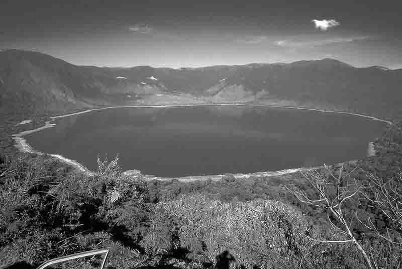
Tanzania is a country of remarkable geographical diversity. From the vast plains of the Serengeti to the stunning beaches of Zanzibar, Tanzania offers a wide range of landscapes. The country is home to Africa’s highest peak, Mount Kilimanjaro, which stands at an impressive 5,895 meters. The Great Rift Valley runs through Tanzania, creating a unique landscape of lakes and mountains. Lake Victoria, the largest lake in Africa, is also located in Tanzania. In addition, the country is home to the Ngorongoro Crater, a UNESCO World Heritage Site known for its abundant wildlife and breathtaking views.
Major cities and regions in Tanzania
Tanzania is comprised of several major cities and regions, each with its own distinct characteristics. Dar es Salaam, the largest city in Tanzania and its economic hub, is located on the eastern coast of the country. Other major cities include Arusha, known as the gateway to the Serengeti, and Zanzibar City, the capital of Zanzibar. The country is divided into 31 regions, each offering its own unique geography and culture. From the lush greenery of the Kilimanjaro region to the arid landscapes of the Dodoma region, Tanzania’s regions showcase the country’s rich diversity.
Natural wonders of Tanzania
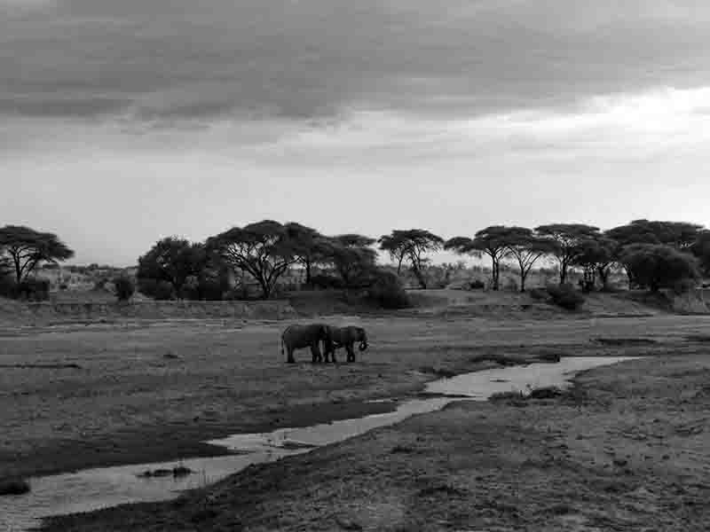
Tanzania is blessed with an abundance of natural wonders that make it a paradise for nature enthusiasts. One of the most famous natural wonders is the Serengeti National Park, which is home to the annual migration of millions of wildebeest and zebras. The Ngorongoro Conservation Area, another natural wonder, is home to the Ngorongoro Crater and a wide variety of wildlife, including lions, elephants, and rhinos. Tanzania is also home to the Selous Game Reserve, the largest protected wildlife area in Africa, and the breathtaking Lake Manyara National Park, known for its tree-climbing lions.
Wildlife and national parks in Tanzania
Tanzania is renowned for its rich wildlife and diverse national parks. The country is home to the “Big Five” – lions, elephants, buffaloes, leopards, and rhinos – making it a popular destination for safari enthusiasts. In addition to the Serengeti and Ngorongoro Conservation Area, Tanzania boasts other notable national parks, such as Tarangire National Park, known for its large herds of elephants, and Ruaha National Park, famous for its diverse bird species. Whether it’s witnessing the wildebeest migration in the Serengeti or spotting a rare black rhino in the wild, Tanzania offers unparalleled wildlife experiences.
Cultural diversity in Tanzania
Tanzania is a melting pot of cultures and traditions. With over 120 ethnic groups, the country is known for its rich cultural diversity. The Maasai people, known for their distinctive red robes and intricate beadwork, are one of the most iconic tribes in Tanzania. The Swahili culture, heavily influenced by Arab and Indian traders, is prevalent along the coast and in Zanzibar. Tanzania’s cultural diversity is also reflected in its cuisine, music, and dance. From tasting traditional dishes like ugali and nyama choma to experiencing the energetic rhythms of traditional Tanzanian music, the country offers a vibrant cultural experience.
Historical significance of Tanzania’s geography
Tanzania’s geography has played a significant role in shaping its history. The country’s location on the eastern coast of Africa made it a strategic trading hub for centuries. Arab and Indian traders frequented the coastal towns, bringing with them goods and ideas that influenced Tanzanian culture. The interior regions of Tanzania were home to powerful kingdoms, such as the Kilwa Sultanate and the Kingdom of Buganda, which played a crucial role in the region’s history. The German and British colonial periods also left their mark on Tanzania, with remnants of colonial architecture still visible in cities like Dar es Salaam.
Using the Tanzania outline map for educational purposes
The outline map of Tanzania serves as an invaluable educational tool for students and teachers alike. By studying the map, students can learn about the geography of Tanzania, its neighboring countries, and its major cities and regions. Teachers can use the map to facilitate discussions on topics such as trade routes, migration patterns, and the impact of geography on culture and history. Additionally, the outline map can be utilized to teach map-reading skills and foster an understanding of spatial relationships. Whether it’s in a geography class or a social studies lesson, the outline map of Tanzania can enhance students’ knowledge and appreciation of the country.
Tanzania’s geography is a treasure trove of natural wonders, cultural diversity, and historical significance. From the vast plains of the Serengeti to the vibrant streets of Zanzibar, Tanzania offers a unique blend of landscapes, people, and experiences. By exploring the outline map of Tanzania, we gain a deeper understanding of the country’s geographical features, major cities, and regions. Whether you’re an adventurer seeking wildlife encounters, a history enthusiast intrigued by ancient civilizations, or a student eager to learn about the world, Tanzania’s geography has something to offer. So grab a map, embark on a journey, and discover the wonders of Tanzania for yourself.


 – Discoveries, Geolo..")
