


")


The Geography of Tanzania – Climate, Statistics, Regions, Extreme Points and More
The geography of Tanzania consists of many national parks and lakes. The highest point in Africa, Mount Kilimanjaro (19,341 feet or 5,895 m), is in Tanzania. The central area of Tanzania is part of a big plateau covered in grasslands, while the northeast part is mountainous. The southern part of Lake Victoria is found on Tanzania’s northern boundary with Kenya and Uganda.
The country is divided into thirty administrative regions – 25 on the mainland, two on Pemba Island, and three on Unguja (informally called Zanzibar Island).
Physical Geography of Tanzania
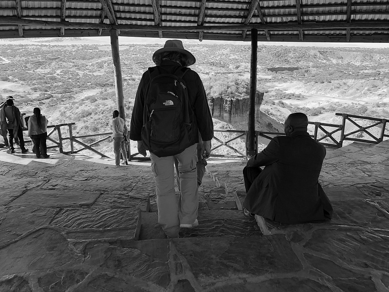
The Tanzania physical geography of its terrain in the northeastern part is mountainous. The area is home to Mount Kilimanjaro, an inactive volcano, Mount Meru, an active volcano, as well as the Pare and Usambara mountain ranges. Thousands of tourists visit Kilimanjaro every year. The Gregory Rift, the eastern branch of the Great East African Rift Valley, is located west of the mountains. There are some large saline lakes on the rift floor, including Eyasi, Natron, and Manyara in the southwest, north, and south, respectively. The rift also includes the Crater highlands, which encompasses the Ngorongoro Crater and the Ngorongoro Conservation Area. The only active volcano that produces natrocarbonatite lava, the Ol Doinyo Lengai, is located south of Lake Natron. The volcano has an elevation of 10,459 feet (3,188 m). Located west of the Crater Highlands is the Serengeti National Park. The park is renowned for its elephants, buffaloes, rhinoceroses, leopards, lions, and the yearly movement of millions of white-beared wildebeest. The Olduvai Gorge is located southeast of the park. Many of the oldest hominid fossils and artefacts have been discovered there.
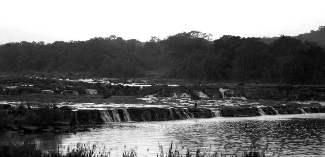
Lake Victoria is located further northwest on the Uganda-Kenya-Tanzania boundary. The lake is the largest lake in Africa in terms of surface area; it is also traditionally named as the origin of the River Nile. Lake Tanganyika is located southwest of Lake Victoria and separates DR Congo from Tanzania. Globally, only Lake Baikal in Siberia is considered deeper than the lake. There are flatlands in the western part of the country between Lakes Tanganyika and Nyasa. The World Wildlife Fund categorizes the flatlands in the geography of Tanzania as part of the Central Zambezian miombo woodlands ecoregion. One of the most significant archaeological locations in Africa is located upstream of the Kalambo Falls. The Southern Highlands of Tanzania are found in the southwestern portion of the country, just around the northern edge of Lake Nyasa. Mbeya is the biggest city in the Southern Highlands.
The middle of Tanzania is a big plateau that is part of the East African Plateau. Located within the Eastern miombo woodlands ecoregion, the southern part of this plateau is grassland, and the large Selous Game Reserve covers the majority of the area. The plateau is farmable up north and includes the capital city, Dodoma.
The largest city and former capital of Tanzania, Dar es Salaam is located on the eastern coast. The Zanzibar Archipelago, a semi-independent Tanzanian territory renowned for its spices, is located north of Dar es Salaam. Mangrove swamps and East African mangroves that are regarded as an important habitat for terrestrial and aquatic wildlife can be found on the coast. A global remote sensing analysis conducted recently suggests that there were 1,256km2 of mudflats in Tanzania, making it the 26th country with the highest mudflat area in the world.
Watersheds in the Tanzania Geography
Rivers that flow into the Indian Ocean drain central and eastern Tanzania. From south to north, the main rivers are the Ruvuma River that forms the southern boundary with Mozambique, Mbwemkuru, Matandu, Rufiji, Ruvu, Wami and the Pangani.
Lake Victoria drains most of the northern part of Tanzania before eventually emptying into River Nile.
The western part of the geography of Tanzania is in the drainage area of Lake Tanganyika, which in turn drains into the Congo River. Lake Tanganyika’s largest tributary is the Malagarasi River.
Some sections of southwestern Tanzania drains into Lake Nyasa, which eventually empties south into the Zambezi River.
Many endorheic basins are found in the Southern Eastern Rift part of north-central Tanzania. These basins do not have any outlet to the sea. They drain into alkaline and/or saline lakes. Another endorheic basin is Lake Rukwa which is located in west-central Tanzania.
Tanzania Geography and Climate
Tanzania’s climate is mainly tropical. However, topography causes regional variations. During the cold and hot seasons, temperatures range between 50 and 680F (10 and 200C) in the highlands, where a subtropical highland climate can be found. The rest of Tanzania has temperatures that rarely go below 680F (200C). The hottest period stretches between November and February (77.0 to 87.80F or 25 to 310C) while the coldest period falls between May and August (59 to 68°F or 15 to 20°C)
The movement of the Intertropical Convergence Zone mainly drives seasonal rainfall. From October to December, it moves southward through the country, reaching its south in January and February, before returning northwards from March through May. This movement makes the eastern and northern part of the geography of Tanzania to have two different wet periods – the long rains (Masika) between March and May and the short rains (Vuli) between October and December – while the central, western, and southern parts of Tanzania have a solitary wet season that continues from October till April or May. A hot semi-dry climate is experienced in some inland zones of Tanzania.
Across the country, the start of the long rains averages March 25th and the stop averages May 21st. A cooler-than-usual Eastern Indian Ocean aided by a warmer-than-usual South Atlantic Ocean usually causes the start to be delayed.
Tanzania Geography Facts Related to Climate Change
We cannot discuss the Tanzania geography now without talking about climate change which affects the residents and the natural environment. Temperatures are rising in the country, with a higher possibility of heavy rainfalls (leading to flooding) and dry spells (leading to droughts).
Lack of water has now become an increasing problem, with many major bodies of water, including Lake Rukwa, Lake Tanganyika, Lake Victoria, and Lake Jipe, experiencing extreme drops in water levels. The country’s agriculture sector, which provides employment for more than 50% of the population, is especially susceptible due to the fact that farmers are mostly dependent on rainfed farming. Conversely, increasing incidents of heavy rainfall have led to flooding across the region, damaging livelihoods and infrastructure. A large percentage of the people of Tanzania live along the coast and depend on aquaculture and fisheries. Rising sea levels and changes in water quality are expected to affect these sectors and may continue to be a challenge for the country. All these issues are related to the geography of Tanzania and how people are reacting to it.
In line with the directive of the United Nations Framework Convention on Climate Change (UNFCCC), Tanzania created a National Adaptation Programmes of Action (NAPA) in 2007. NAPA identified the areas of water, agriculture, energy, and health as the most exposed to climate change in Tanzania. Tanzania formulated a National Climate Change Strategy in 2012. The strategy was a response to the rising concern on the adverse effect of climate variability and climate change on Tanzania physical geography, social, and economic environment. Tanzania forwarded its Intended Nationally Determined Contributions in 2015.
Statistics Related to the Geography in Tanzania
Continent: Africa
Location: East Africa, bordering the Indian Ocean, between Kenya and Mozambique
Geographic coordinates: 6°00′S 35°00′E
Area:
- total: 365,800 sq mi (947,300 square kilometres)
- land: 342,000 sq mi (885,800 square kilometres)
- water: 23,700 sq mi (61,500 square kilometres)
Note that these figures include the islands of Unguja, Pemba, and Mafia
Land borders:
- total: 2,399 mi (3,861 km)
- border countries: Kenya 478 mi (769 km), Burundi 280 mi (451 km), DR Congo 285 mi (459 km), Uganda 246 mi (396 km), Malawi 295 mi (475 km), Zambia 210 mi (338 km), Rwanda 135 mi (217 km), Mozambique 470 mi (756 km)
Coastline: 885 mi (1,424 km)
Maritime Claims:
- territorial sea: 8 mi (22.2 km; 12 nmi)
- exclusive economic zone: 93,393 sq mi (241,888 km2) and 370.4 km (200 nmi; 230.2 mi)
Terrain: highlands in the south and north, plain lands along the coast
Elevation extremes:
- highest point: Kilimanjaro 19,341 feet (5,895 m)
- lowest point: Indian Ocean 0 m
Natural resources: gemstones, coal, tin, natural gas, hydropower, nickel, phosphates, iron ore, diamonds, gold
Land use:
- permanent crops:79 percent
- arable land:25 percent
- other:96 percent(2011)
Irrigated land: 712 sq mi (1,843 square kilometres) (2003)
Total renewable water resources: 23.10 cu mi (96.27 cubic kilometres)
Natural hazards:
- drought and flooding of the central plateau during the rainy season;
- volcanism:limited volcano activity; Ol Doinyo Lengai (elevation 9,718 ft (2,962 metres)) has emitted lava recently; other historically active volcanoes include Meru and Kieyo
Environment – present issues: deforestation, desertification, soil degradation, coral reef destruction threatens marine environments; recent droughts affected marginal agriculture; illegal hunting and trade for ivory threaten wildlife.
International agreements on the environment:
Tanzania is a party to the following:
- Convention on Wetlands of International Importance, especially as Waterfowl Habitat
- Kyoto Protocol to the United Nations Framework Convention on Climate Change
- Convention on International Trade in Endangered Species of Wild Fauna and Flora
- Vienna Convention for the Protection of the Ozone Layer
- United Nations Convention to Curb Desertification in Countries Experiencing Serious Drought or/and Desertification, Especially in Africa
- United Nations Framework Convention on Climate Change
- Biodiversity
- Basel Convention on the Control of Transboundary Movements of Hazardous Wastes and Their Disposal
- United Nations Convention on the Law of the Sea
Specific Geographical Areas
- Kilimanjaro
- Umbai Valley
- Oldupai Gorge
- Meru
- Menai Bay Conservation Area
Geography Tanzania – Extreme Points
Below is a list of the extreme points in Tanzania; these points are farther south, north, west, or east than any other place
- Southernmost point – unnamed spot on the Mozambique boundary in the Ruvuma River
- Northernmost point – unnamed spot on the Uganda border in the Kagera River, east of the Kikagati township in Uganda
- Westernmost point – unnamed highland area located west of Ujiji in the Kigoma Region
- Easternmost location (mainland) – unnamed headland, east of Mwambo township in the Mtwara Region
- Easternmost location – Mnazi, in the Mtwara Region
Geography Now Tanzania
See a Youtube video here that gives you a quick snapshot of the Geography of Tanzania in video format:
For more articles related to Geography of Tanzania, click here!


