


")


")
Things to Know About Kipengere Range (Livingstone Mountains)
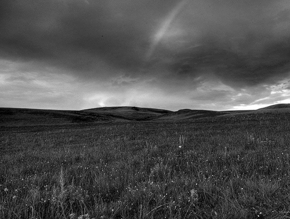
Kipengere Range also referred to as the Livingstone Mountains, is in southwest Tanzania at Lake Malawi’s northern end. Around Lake Malawi, the mountains are called Kinga Mountains. It’s a plateau-like mountain ridge extending southeastwards from the Great Ruaha River basin in the north to the Ruhuhu River southwards and is part of the East African Rift Valley‘s eastern escarpment. The range mostly has montane grasslands, famous for their flower displays and botanical diversity, with stream valleys having mostly montane evergreen forests.
Other sources use the Livingstone Mountains or the Kipengere Range or to describe the whole range, while others differentiate the Livingstone Mountains as the escarpment facing southwest running on Lake Malawi’s shores, while the Kipengere Mountains as the high ridge describing Kitulo Plateau’s northeastern edge.
Geography
From the Mbeya town, Kipengere range goes south-east to form a section of the East African Rift valley’s eastern escarpment, extending around 100 kilometres down the lake shores in the northeast to Ruhuhu River. Poroto volcanic mountains form the Kipengere’s north-western extension.
Partly, the Kipengere range exhibits more plateau characters than those of a real mountain range; however, the latter name is justified by the formation of a country with a comparatively narrow belt, which falls significantly in the east and west. The range mostly lies over 2000 meters high. The northern section is well-marked in 8° 50′ South with an escarpment extending to Usangu Plains, East African Rift’s eastern branch, and the Great Ruaha River basin.
The Kipengere range terminates southwards in Ruhuhu River’s deep valley in 10° 30′ south, the initially decided highlands break is accessed northwards along Lake Malawi ‘s east coast. Going southwards, the Kipengere range seems to be just 20 miles wide, although it widens out to around 40 miles northwards, though depression breaks it here, drained in the direction of the Great Ruaha, with Mtorwe (2961 miles) on the south side, the Kipengere range’s highest known peak.
Kitulo Plateau, originally Elton Plateau, is an elevated plateau in the Kipengere range’s northern section, featuring tall ridges extending north west-south east. Ishinga and Mtorwe (2688 metres) overlook the Valley of Great Ruaha River, as Chaluhangi (2933 metres) overlooks the basin of Lake Malawi. Ngosi (2621 metres) is Poroto Mountains’ major peak.
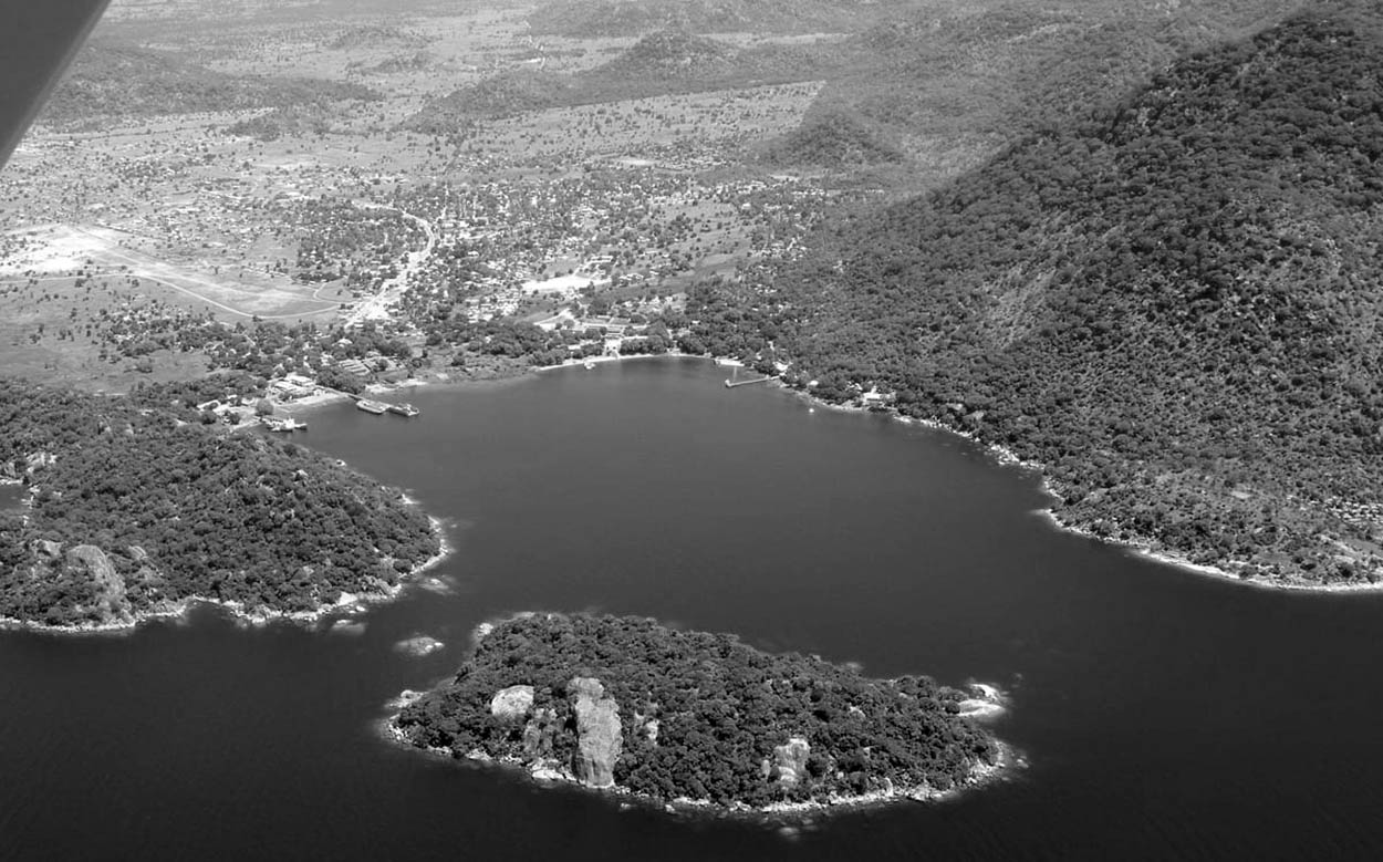
At the bottom of the mountains on Lake Malawi include the ports of Manda, neighboring the mouth of the Matema and Ruhuhu, at the lake’s northeast corner.
People
The Manda, Nyakyusa, and Kisi people inhabit the shore of Lake Malawi on the Kipengere range’s southwestern escarpment. The Kinga, Magoma, Pangwa, Ngoni, Nena, and Wanji, and people inhabit the Kipengere range’s interior.
Geology
In geological terms, the Kipengere range formed from ancient Precambrian rocks. A gneiss zone runs on the Kipengere range’s southwestern face overlooking Lake Malawi, in various valleys and ridges generally aligned to its centre. The ridge closest to the lake (Mount Camembert or Jambi , at 9° 41′ South), rises to a maximum height of 2,400 metres (7,900 feet), falling 1,900 metres (6,200 feet) more or less sheer to water, the similar steep slope going on underneath the surface.
Buanyi ‘s northeast, just like in the Kipengere range’s eastern half generally, table-topped mountains happen, having horizontally bedded quartzites, conglomerates, and sandstones above. The Poroto Mountains with a volcanic origin and younger volcanic rocks in the Kipengere range’s northwestern section related to mount Rungwe Volcanic zone overlie older Precambrian rocks.
Kipengere Range Climate
Precipitation mostly comes from convectional thunderstorms from beyond Lake Malawi. Kitulo Plateau’s mean annual rainfall is 1500 millimetres, with rainfall greater at higher altitudes on the lake-facing slopes. Most rainfall happens from November to May in the rainy season, with April being the wettest month. May to October is a dry season, having nightly frosts popular from June to August. Successful cultivation of temperate crops is possible.
Kipengere Range Ecology
Montane grassland generally covers the Kipengere range. Grasslands inhabit 350 plant species, including various geophytes, ground orchids, and more afro-alpine plants. Montane grasslands are covered by various flowers in the wet season. Various species are restricted to the Kipengere Range including neighboring highlands, with three – Pterygodium ukingense, Brachystelma kituloensis, and Impatiens rosulata – are restricted to Kitulo Plateau.
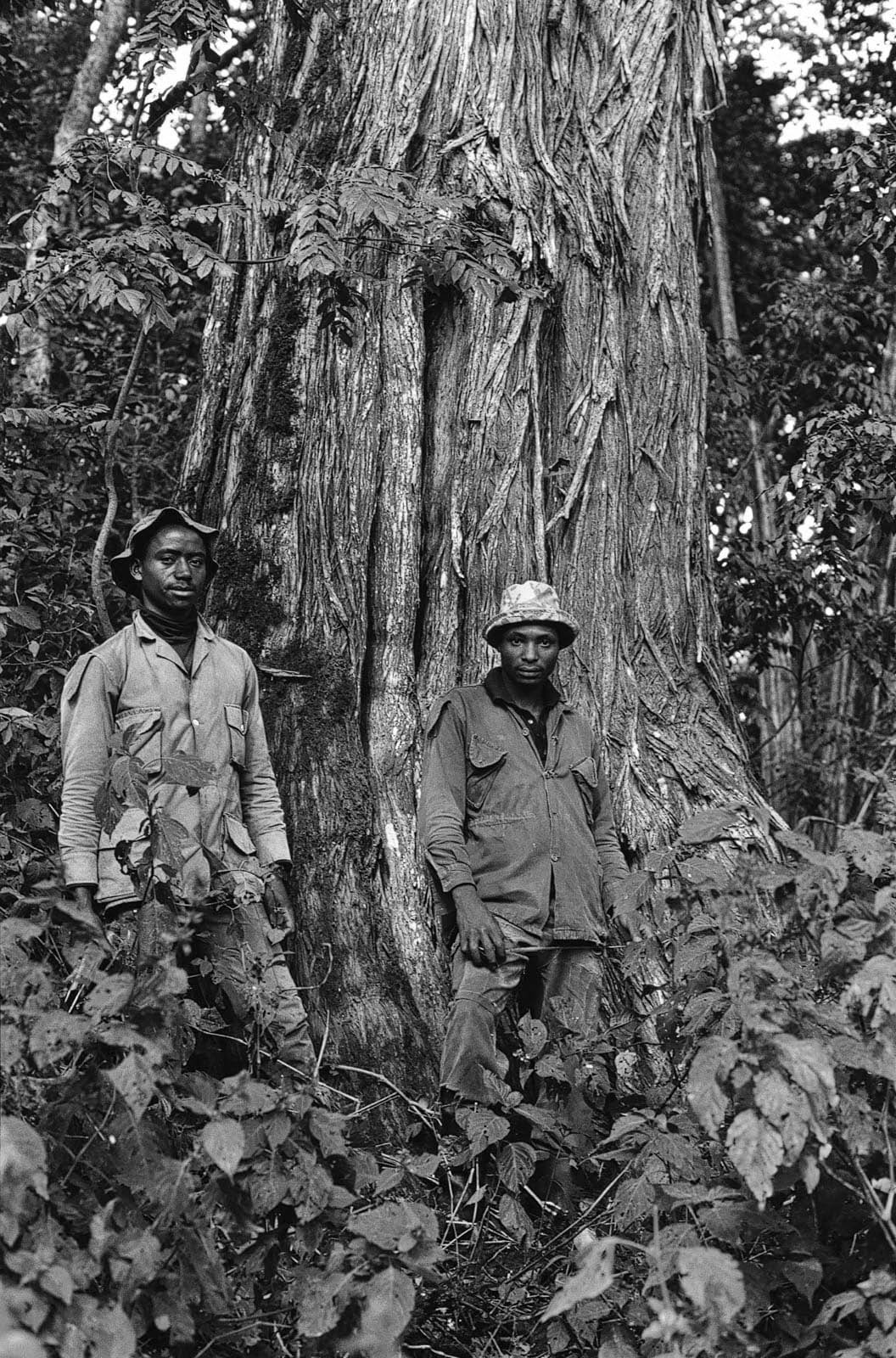
Hollows and river valleys have Montane evergreen forests. The slopes facing south at the Kipengere range’s northwestern end, which used to be the Livingstone Forest Reserve but now belong to Kitulo National Park, possess a great extent of areas with montane evergreen forest. Ndumbi forest, at Kitulo National Park’s eastern end, has East African Cedar (Juniperus procera) and montane evergreen forests. Bamboo thickets (Yushania Alpina) exist from the upper montane forests to the high elevation grasslands.
Miombo woodland surrounds the Kipengere range at lower elevations — Eastern Miombo woodlands in the east, north, east, and south, with Central Zambezian Miombo woodlands in the west.
Kipengere Range Preserved Areas
Established in 2005, Kitulo National Park covers 465.4 kilometres squared. The new park included the Livingstone Forest Reserve (240.34 kilometres squared) and Ndumbi Valley forest Reserve (27.71 kilometres squared, established 1956). The reserves protected larger tracts of bamboo thickets and montane evergreen forest in the Kipengere range, with the park also including the montane grasslands of Kitulo Plateau lying between montane grasslands and the two forest reserves in the southeast.
Created in 2002, Mpanga-Kipengere Game Reserve covers 1,574 kilometres squared in the Kipengere range’s northeastern section, with an adjacent section of the Usangu Plains. The reserve included the 350.78-kilometres squared Kipengere Range Forest Reserve, created in 1958. The planned Ndukunduku forest reserve (27.19 kilometres) would join Mpanga-Kipengere Game Reserve and Kitulo National Park.
Irungu Forest Reserve, 240.32 kilometres squared, in the Kipengere range’s northwestern edge-sharing a boundary with Kitulo National Wildlife Park in the south. Established in 1960, Chimala Scarp Forest Reserve, on the Kipengere range’s northern escarpment facing the Usangu Plains in the north, covers 180.68 kilometres squared.
Preserved areas in the Kipengere range’s southern section are not extensively studied or well-protected as those in the north. These include Mdando (5,140 hectares), Madenge (1,146 hectares), Sakaranyumo (840 hectares), and Msiora (315 hectares) forest reserves.
For more articles related to Mountains of Tanzania, click here!


