


")


Quick Overview of the Mara River in Tanzania
The Mara River in the Mara Region of Tanzania and the Narok County of Kenya lies across the Maasai Mara/Serengeti National Park ecosystem in the migration path of hooved animals.
The River’s Path
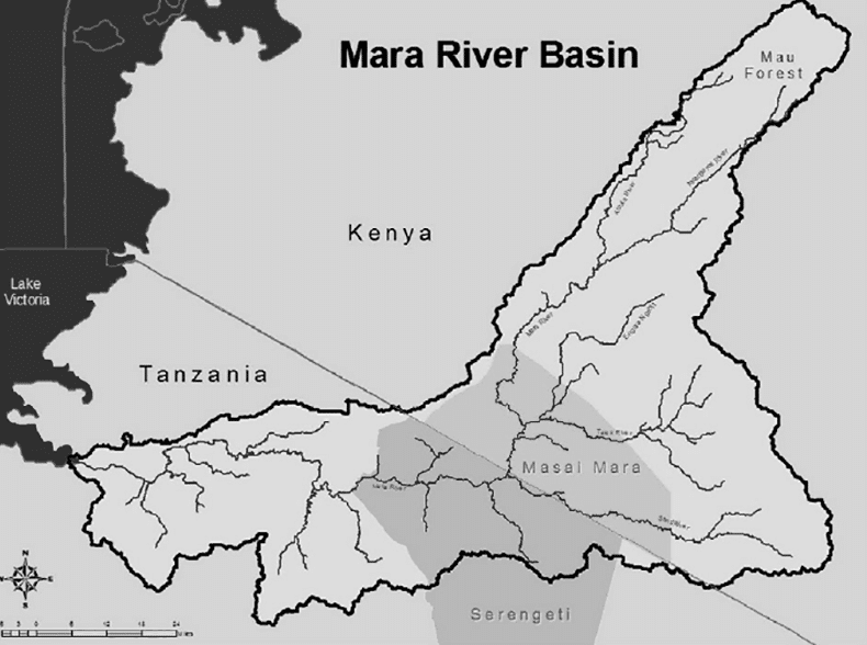
The Mara River is situated in both Tanzania and Kenya. Approximately 35% of the river’s 13,504 sq km basin is in Tanzania, and 65% in Kenya. Its source is in the Kenyan highlands, and from there, it flows for approximately 395 km. The river Mara starts at the Mau Escarpment and runs towards Lake Victoria, where it drains.
The Mara River’s basin can divide into approximately four administrative and/or land use units.
The River’s Regions
The Source: The Napuiyapi swamp (where the Mara River originates) is situated at 2,932 m in the Kenyan highlands. Its main perpetual branches are the Nyangores, and the Amala streams, which flow from the Mau Escarpment situated west. This region supports forests, small-scale agriculture (up to 10 acres), and medium-size farms (approximately 40 acres of mainly tea).
Kenyan Rangelands: This area is home to the Nyangores and Amala streams which flow from the Mau Escarpment to join together as the Mara River. The newly formed Mara River then curves through gaping savannah grasslands. These grasslands are ruled mainly by group ranches of the Maasai tribe who use them as livestock pastures and small to large-scale agricultural land (over 40 acres). The Loita Hills are also situated in this area alongside four important branch stream basins of the Mara – the Engare, Engito, Sand, and Talek rivers.
Protected Areas: Once the river reaches the internationally-known Maasai Mara National Reserve, it merges with three of the above mentioned branches. The river continues to flow until it reaches the Serengeti National Park on the Kenyan-Tanzanian border, where the remaining branch (the Sand – also known as Longaianiet – River) joins it. Human activity is restricted to wildlife viewing.
The Mara Region: The Mara River flows downstream from the Ikorongo Game Reserve, which borders the Serengeti National Park. It curves southwest, where after the main river divides into different branches which feed the Mara wetlands. These branch streams and wetlands continue downstream for approximately 70 km.
The primary use of land in this part of the basin is for small-scale livelihood farming. Humans and livestock crowd the area.
The Mara River is categorized as a functional and ecological river related to socio-economic activities in Lake Victoria and beside the River Nile. It is one of ten basins that drain into and feed Lake Victoria.
Altitudes and Ranges
The Mara River basin is between 1,134 m and 2,932 m high, with the highest point at its sources in the Mau Escarpments and its lowest at Lake Victoria.
Rainfall in the regions of the Mara River is unpredictable. The different regions receive rainfall at varying times of the year. The rainfall season in the Mara River regions has two peaks, with mid-March as the starting date for the long rains, April for its peak, and June for its end. The short rains fall between September and December.
The amount of annual rainfall that the Mara River receives varies based on these altitudes. The lowest area around Lake Victoria and the low Loita Hills of Kenya receive approximately 700 – 800 mm of rain. The transfrontier savannah grassland (situated in the middle) averages approximately 900 – 1,000 mm. Around the highest point at the Mau Escarpments, rainfall averages between 1,000 – 1,750 mm.
The Effects of the Mara River
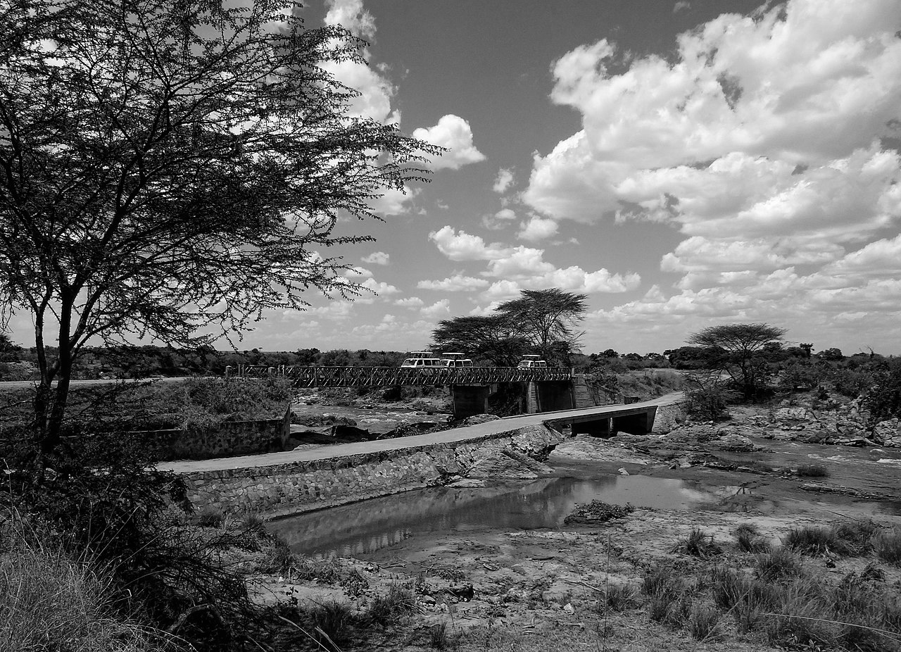
While the Mara River may appear shallow during dry seasons, it can swell to double its size once heavy rainfall has occurred. During this time, it is an essential water source for grazing animals in the reserve. However, it can also create rapids within the river. When this happens, predators who cannot cross the river to hunt experience food shortages.
Mara River Africa
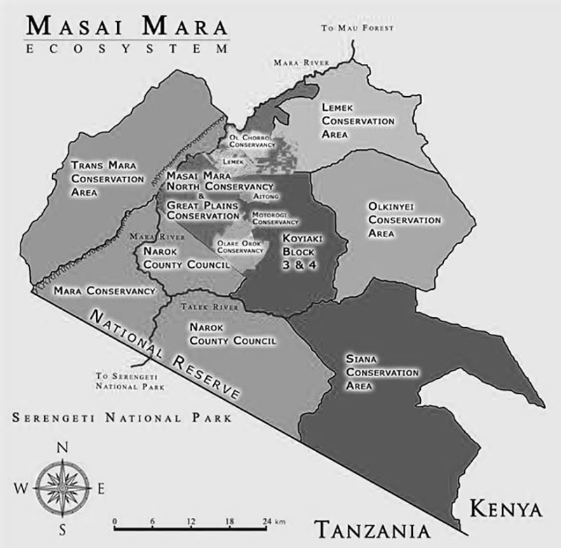
Check out this Mara river map:
Mara River Facts
There are many interesting facts about the Maasai Mara River. You might be wondering where is the Mara river? Well, it lies right between Kenya and Tanzania.
Here are some interesting facts about the Mara Mara river:
Mara River Crossing
The Tanzania and Kenya Mara river lies directly in the path of migration for multiple African animals.
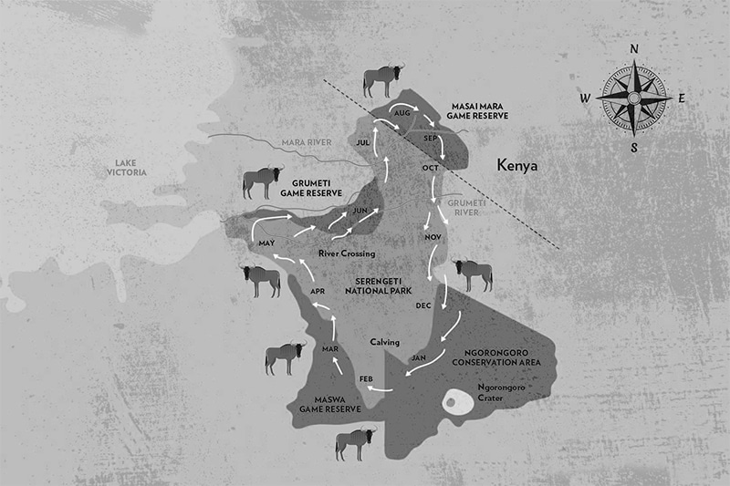
The Mara river migration is an event that happens each year. Over two million wildebeest, zebra, and other herbivores trek from the southern Serengeti to the Masai Mara River.
There are plenty of safari tours that will allow you to witness the great migration mara river crossing at a safe distance. The mara river crossing best time is in August, though it will continue through September
Check out this Mara river crossing points map:
Animals in Mara River
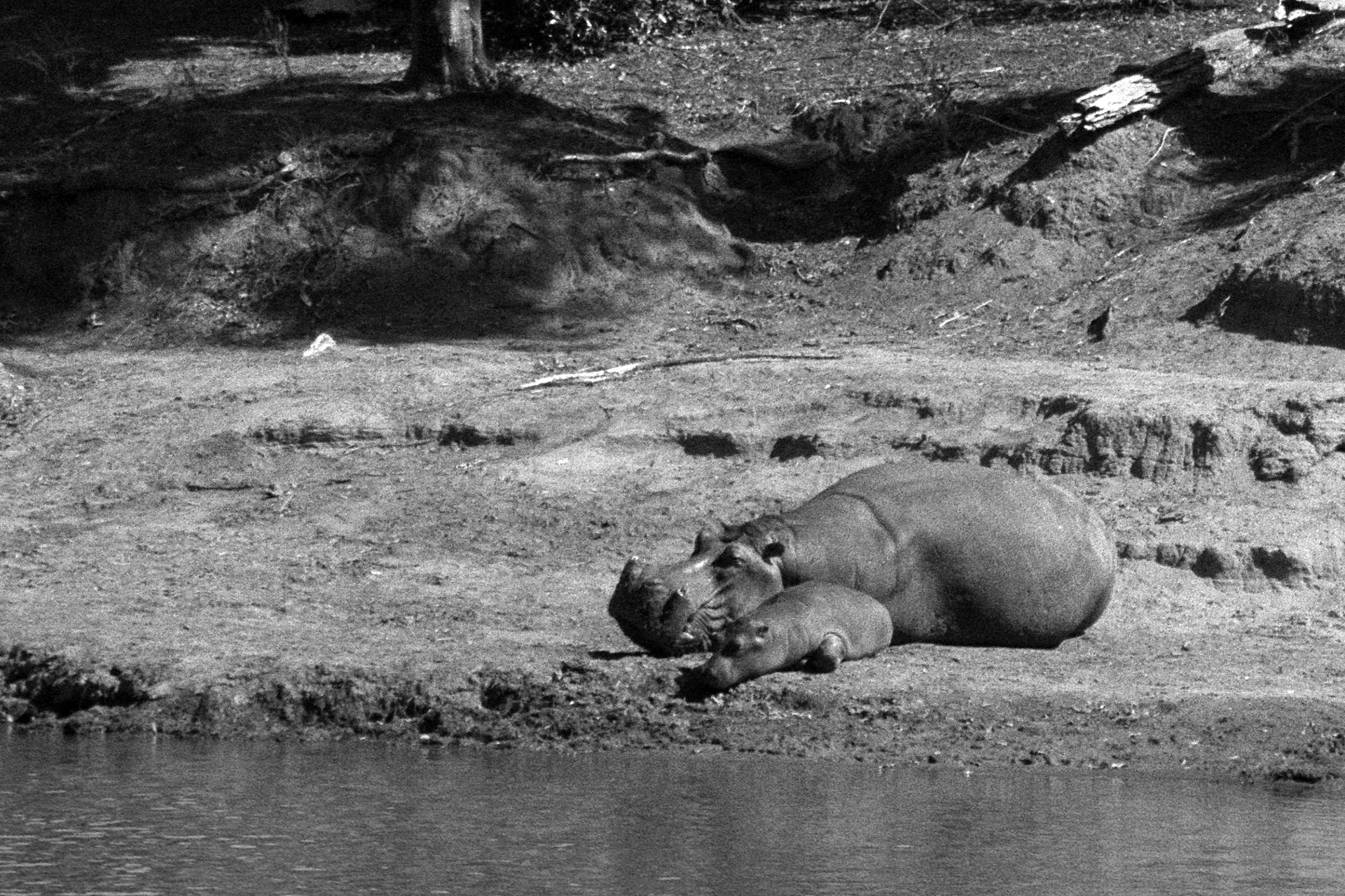
The Mara river Kenya is home to many animals like hippos and Nile crocodiles. The Mara river crocodiles are well-known for their attacks during migration season. Around the Mara river in Kenya you’ll also find ungulates, zebras, and other mammals.
Check out this Mara river Kenya map with some of the animals that migrate through the river:
Mara River of Death
Sadly, the Mara River crossing is very dangerous. The Mara River Tanzania is also known as the Mara River of Death due to the carnage that happens annually at its crossings. There have been many mara river crossing crocodile attack reports, where thousands of ungulates die.
There’s even a mara river of death documentary! This mara river documentary shows the crossings of animals and the deadly consequences.
The Mara River in the Bible?
Some people believe there are mentions of the mara river in the bible. However, the Marah mentioned in the book of Exodus is not the same place.
Where to Stay While Visiting the Mara River in Kenya and Tanzania
Singita Mara River Camp
The Singita Mara river tented camp is a campsite located in the remote Lamai triangle in the Serengeti.
Additionally, this Mara river tented camp offers and intimate sanctuary with great travel services and activities.
Gnu Mara River Camp
This Mara river camp is located in Serengeti, just a few minutes drive away from the river. It offers comfortable amenities and exciting activities.
The Mara river camp Serengeti offers game drives, balloon rides, and safari tours.
Mara River Lodge Kenya
This Mara river camp Kenya is located at the edge of the Maasai Mara National Reserve. It has one of the most impressive views in the Serengeti.
Mara River Safari Lodge Hotel
This Mara river lodge is also known as the Mara river safari lodge Bali. It is a safari-themed that offers a unique holiday experience.
The Mara river lodge Bali features rooms with an open-air terrace, so the guests can observe different animals at close range.
Sand River Masai Mara by Elewana
The Elewana sand river masai Mara is located on the banks of the Sand River Masai Mara.
The Sand River Masai Mara is close to the Tanzanian border. This Mara river camp Tanzania offers exclusive permanent tented camps of the late 1920’s.
Mara River Post
The Mara River Post is located in the Serengeti Mara area of northern Tanzania. It offers stylish en-suite safari tents and hosts lots of activities, like safari tours.
The Mara river post tripadvisor page has a 4.5 Excellent score, with over 30 positive reviews.
For more articles related to Rivers of Tanzania, click here!


