


")


Quick Overview of the Pangani River in Tanzania
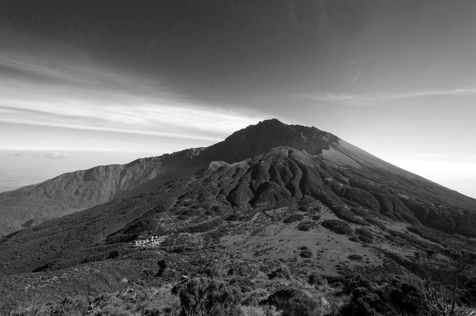
The Pangani River in Tanzania is also known as Jipe Ruvu, Luffu, and possibly Rhaptus. It is a big river in the northeast of the country and has two primary sources. The first is the Ruvu which originates at Kilimanjaro as Lumi before passing by way of Lake Jipe and emptying in the Nyumba ya Mungu Reservoir. The second source is the Chemka Hot Springs (Kikuletwa) which is primarily fed by Mount Meru and flows from the west into the Nyumba ya Munga Reservoir. These two sources join when exiting the reservoir and the Pangani River. The Pangani flows to the seaside town of Pangani, where it empties in the Indian Ocean.
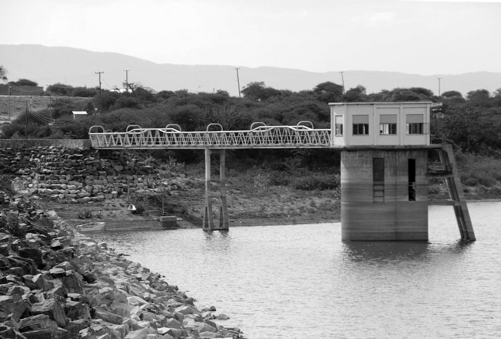
The Pangani River mainly runs along the Kilimanjaro and Manyara Region’s regional borders before entering the Tanga Region, where the Pangani Falls Dam and the Pangani Power Station (of 68 MW) are situated. The river has inhabited islands, and crocodiles, as well as hippopotami, live there.
Etymology of River Pangani
River Lumi is one of the Pangani River’s main sources and begins on Kilimanjaro. Lake Jipe is considered as Lumi’s backwater. The river is often named the Ruva above the falls and below it, Lake Jipe.
While it was decided that the name “Pangani” will be used for the stream flowing into the Ocean from the Nyumba ya Mungu reservoir, it was formerly called both Pangani and Ruva.
The Wasambara tribe, native to the Nderema Region situated near the coast on three ridges, and the Wasegua tribe, native to the river’s islands, call the river Luffu. At the same time, the Sudheli language refers to it as Pangani.
Nearly all officials agree that the Rhaptus River on Ptolemy’s topographical maps is the Pangani River displayed on current maps.
Geography
The Pangani River flows for 500 kilometers.
Source
The Lumi is one of the Pangani River’s sources. It lies about 190 km from the sea on the rises of Kilimanjaro. The Lumi flows via Lake Jipe.
The second branch of the Pangani River is Kikuletwa. It originates from the west at Mount Meru.
Similar to other African rivers, the Pangani has varying depths. The river’s depth is dependant on the annual seasons, with its peak around May and its shallowest time around October.
Midsection
The Pangani River has many branches and islands with villages below the Höhnel Cataracts. Between the lake and Höhnel Cataracts, the river has a chain of rapids navigable by small crafts.
Koleni is situated approximately 8 kilometers from the Pangani Falls. The river has a strong, narrow stream above Koleni which can not be navigated due to the falls situated about 48 kilometers from the mouth.
Condensed mangrove swamps are found about 6.4 kilometers from the mouth and cover flatland in the middle of the hills on both sides. The dry Masai Steppe and a fertile region are higher up near Teufelsfelsen. Mount Kovu Kovu is also on this bank at 110 m high. A 120 m high ridge is found on the southern bank.
One of the river’s main settlements, Pombwe, is approximately 1.6 kilometers to Kovu Kovu’s west. The West African oil palm grows above Pombwe, while the trees below it are coconut palms and areca.
The Ngage hamlet and Lemkuna village are on the west bank of the Pangani River, while Meserani and Mvungwe are on the east.
Mouth
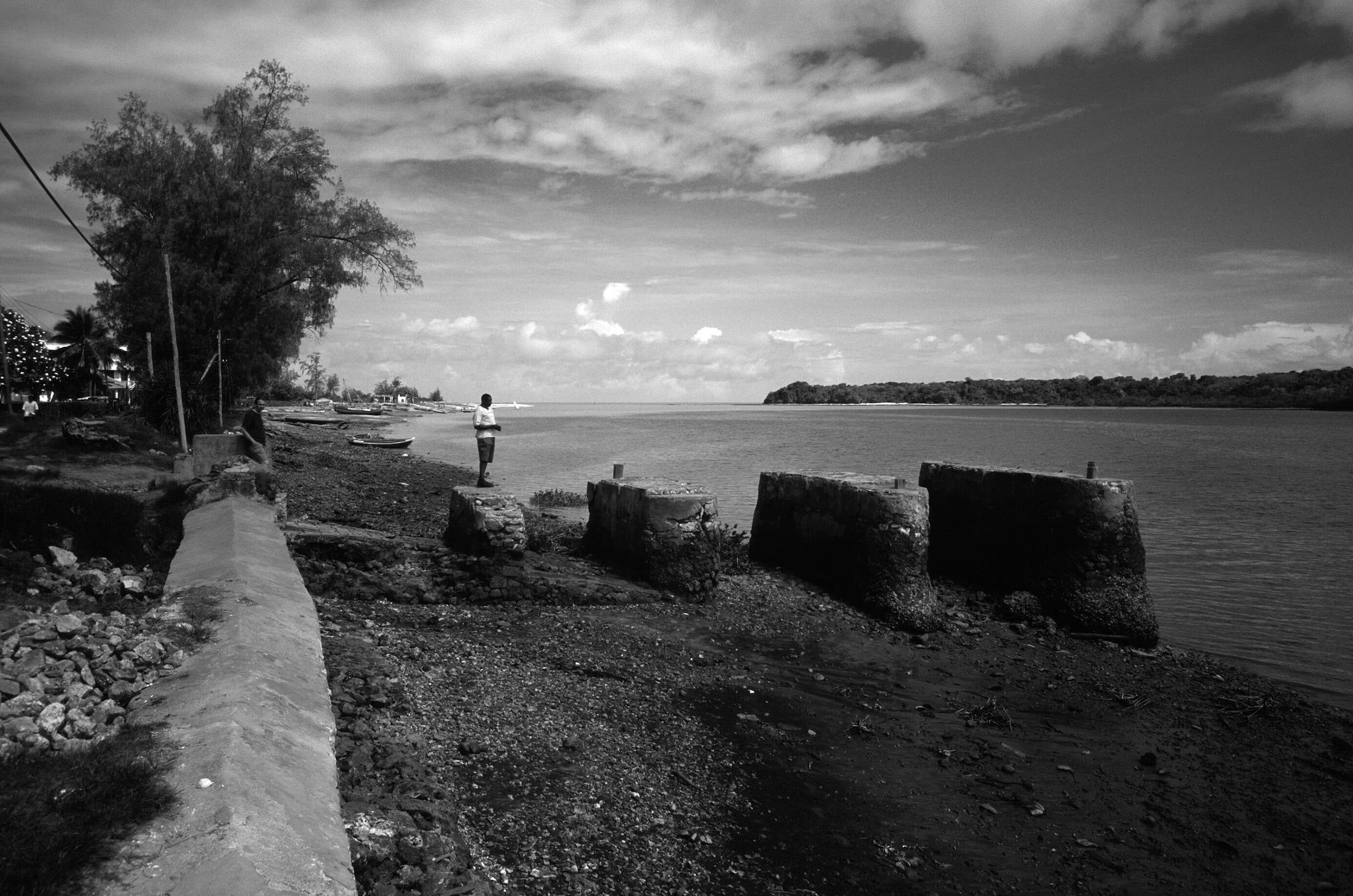
The river mouth is situated 52 kilometers to Tanga’s south. From the entrance, it freeflows for 35 kilometers. Approximately 61 m high, a perpendicular bluff called Bweni marks the south side of the entrance. A village with the same name is also situated there.
A flat sandy shore extending from the head of the bay marks the entrance’s northern side. The entrance hosts two settlements on the north bank and two on the south bank.
The Pangani town situated on the left bank of the river was known for fever cases throughout history. At Pangani town, the river is approximately 180 m wide and 3.7 – 4.6 m deep at its discharge.
Branches
The Pangani River is joined by several branches from the Wasegja wilderness, the Usambara Mountains, and the Pare Mountains. These branches include the Mnyusi, Kwachigulu, Komkuza, Kwamwadyau, and Kibaya.
Hydrometry
The hydrological station in the Korogwe Estate, situated approximately 110 kilometers above the mouth, measures the average monthly flow of the Pangani River in m³ / s. The river flows are time-dependent like most rivers in the area.
Pangani River Basin
In July 1991, the Pangani Basin Water Board (PBWB) was established under the Water Utilization (Control and Regulation) Act No. 42 of 1974. Its headquarters is situated in the Moshi municipality in the Kilimanjaro area. It also has two offices in Tanga and Arusha. The PBWB is made up of private sector LGAs, UWSAs and public institution professionals, and other committee members.
Tanzania has nine drainage basins, and the Pangani Basin is one of them. The basin is about 56,300 sq km and extends from Tanzania’s northside highlands to its north-eastern shoreline. Of this, 4,880 sq km is situated in Kenya. The river basin contains five sub-basins. Basins included are the Pangani River (43,650 sq km), the Msangazi River (5,030 sq km), the Umba River (8,070 sq km), the Zigi River, and the Mkulumuzi River combined with other seaside rivers (2,080 sq km). All these basins empty into the Indian Ocean.
The Pangani river is under much pressure due to clashing water uses and the large overallocation of it. Several farmers rely on it to water their crops. Damming projects surrounding the river have also reduced its flow to under 40 cubic meters from several hundred per second. A large reduction in saltwater intrusions and fish populations has affected seaside communities.
The Pangani River Basin Management Project was started in 2002 to manage the basin’s water resources. The IUCN (International Union for Conservation of Nature), the SNV Netherlands Development Organisation, and the PAMOJA local non-governmental organization offered technical assistance to the project. The IUCN, the Global Environment Facility, the European Commission, and the Tanzanian government also funded it through the United Nations Development Programme.
Commerce
In 1878, sugar was the primary crop cultivated on the banks of the Pangani River. Dhow’s load and unload on the river as part of the area’s trade. Rafts made from Moale palms are broken up and sold after the produce they bring down the river is unloaded.
For more articles related to Rivers of Tanzania, click here!


